| Place | Map Lat. N Lon. W |
Population Year/People |
History | Topo Map |
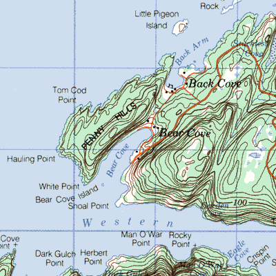
| Bear Cove (Hauling Point) with Back Cove, Sandy ~, and Stuckless ~ | 12H/15 49° 50' 56° 34' |
1874/19 1921/150 1935/106 1966/135 1968/170 |
settled by 1870 abandoned by 1970 |
 |
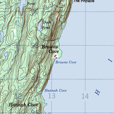
| Browns Cove | 12H/10 49° 38' 54° 49' |
1874/9 1941/33 1945/39 |
settled by 1870 abandoned by 1960 |
 |
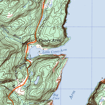
| Coney Arm (Great ~ ~ and Little ~ ~) | 12H/15 49° 58' 56° 47' |
1857/33 1921/56 1935/48 |
settled by 1857 abandoned by 1954 |
 |
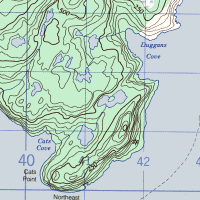
| Duggans Cove (Orange Bay) with Cats Cove and Jacques (Jacks) Cove | 12I/8 50° 23' 56° 25' |
1874/15 | settled by 1874 abandoned after 1928 |
 |
| Four Harbour | 2M/4 51° 11' 55° 44' |
/ | vacated or seasonal settlement | 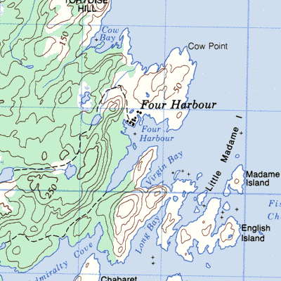 |
| Granby Island | 12H/10 49° 44' 56° 44' |
1941/39 | / | 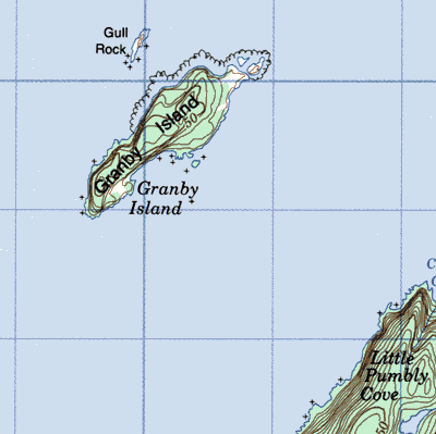 |
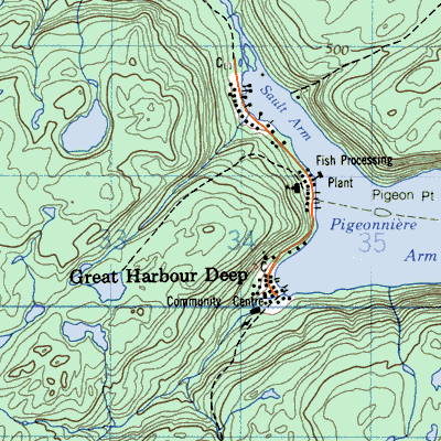
| Great Harbour Deep (Orange Bay)with Cats Cove, Jacques Cove and Souflets Arm | 12H/10 50° 23' 56° 29' |
1850/4 1868/59 1891/107 1945/200 |
French fishing station from mid 1600's abandoned 2002 |
  |
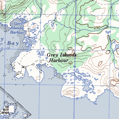
| Grey Islands (~~ Harbour) (Groais Island and Belle Island) with French Cove and Sandy Cove | 2L/12 50° 43' 55° 36' |
1854/16 1974/1110 1884/166 1941/164 1951/81 1956/111 1961/86 |
fishing station from 1600's settled by 1850 abandoned by 1966 |
 |
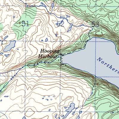
| Hooping Harbour | 12I/9 50° 37' 56° 16' |
1857/17 1901/51 1911/86 1935/148 1945/171 1954/199 1961/166 |
French station after 1700 settled by 1857 abandoned 1969 |
 |
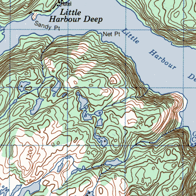
| Little Harbour Deep | 12I/2 50° 15' 56° 33' |
1901/17 1911/43 1941/34 1956/58 1966/10 |
settled by 1900 abandoned after 1966 |
 |
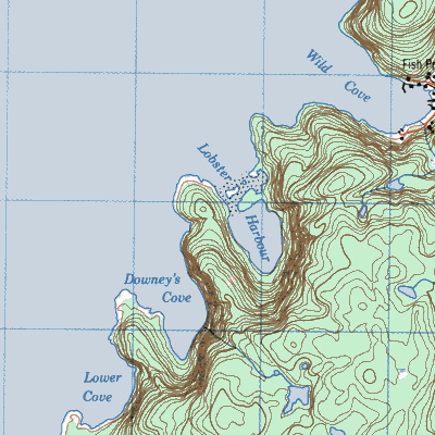
| Lobster Harbour | 12H/16 49° 59' 56° 22' |
1857/12 1874/36 1935/10 |
used from early 1600's settled early 1800's abandoned by 1945 |
 |
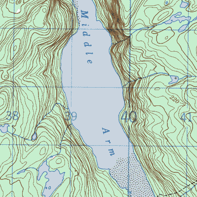
| Middle Arm | 12H/16 49° 51' 56° 26' |
1874/42 1891/57 1945/15 |
settled by 1874 abandoned after 1945 |
 |
| Northeast Arm, Harbour Deep | 12I/8 50° 24' 56° 29' |
/ | vacated or seasonal settlement | 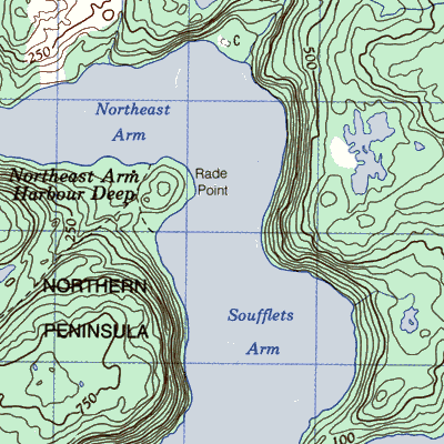 |
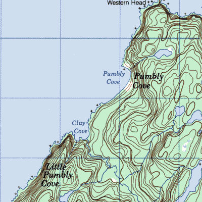
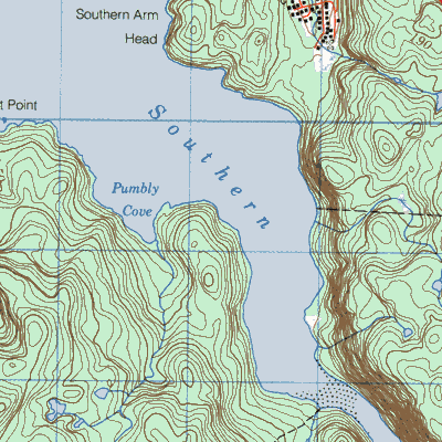
| Pumbley Cove | 12H/10 49° 44' 56° 41' |
1857/8 1891/28 1941/41 1951/50 1956/42 |
settled by 1850 abandoned 1957 |
 |
| Sops Island | 12H/15 49° 46' 56° 51' |
1857/29 1901/45 1935/211 1951/324 1966/39 |
settled 1763 abandoned 1966 |
 |
| Southern Arm | 12H/16 49° 55' 56° 24' |
1884/5 1891/41 1921/54 |
settled in 1880's abandoned after 1921 |
 |
| Western Arm | 12H/15 49° 49' 56° 31' |
1935/83 1941/83 1956/72 |
settled by 1880 abandoned 1959 |
|
| Wild Cove (~ ~ #2) | 1874/14 1881/2 families 1911/3 |
settled by 1880 abandoned by 1914 associated with Western Arm |
 | |
| Williamsport (Greens Pond before 1911) | 12I/9 50° 32' 56° 19' |
1901/83 1951/188 1971/15 |
French station until 1870 settled 1890's abandoned after 1971 |
 |