| Place | Map Lat. N Lon. W |
Population Year/People |
History | Topo Map |
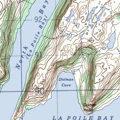
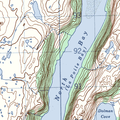
| Dolmans Cove | 11O/16 47° 45' 58° 19' |
1921/9 | seasonal settlement after 1900 settled by 1921 abandoned by 1925 |
 |
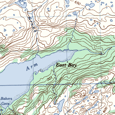
| East Bay | 11O/16 47° 46' 58° 15' |
1891/13 1921/25 1945/13 |
seasonal to 1891 settled by 1891 abandoned after 1945 |
 |
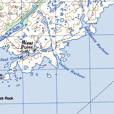
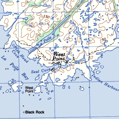
| Indian Harbour | 11O/9 47° 39' 58° 25' |
1836/5 1869/21 1891/14 1951/5 |
French use before 1800 settled early 1800's abandoned after 1951 |
 |
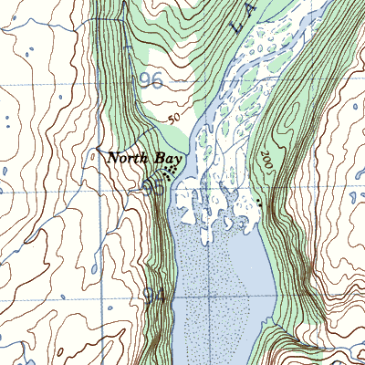
| North Bay | 11O/16 47° 47' 58° 20' |
1891/8 1921/27 1935/51 1961/44 |
seasonal use to 1890 settled by 1891 abandoned 1968 |
 |
| North West Cove | / | 1857/10 1891/18 1921/11 |
settled by 1857 abandoned after 1921 |
 |
| Round Harbour | 11O/9 | 1901/6 1921/1 |
settled in 1850's abandoned after 1921 |
|
| West Point | 11O/9 47° 39' 58° 26' |
1845/48 1857/102 1869/156 1884/170 1921/116 1941/91 1966/128 |
settled early 1800's abandoned after 1969 |
 |