| Place | Map Lat. N Lon. W |
Population Year/People |
History | Topo Map | |
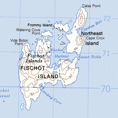
| Fischot Islands (Fishot ~; includes Great and Little Coromandier ~, Great and Little Verdon ~, Massacre Island, Monk ~, Frommy ~, and Pigeon ~) | 2M/4 51° 11' 55° 41' |
1857/37 1884/67 1941/48 |
French station to 1890's settled before 1857 partially abandoned by 1980 |
 | |
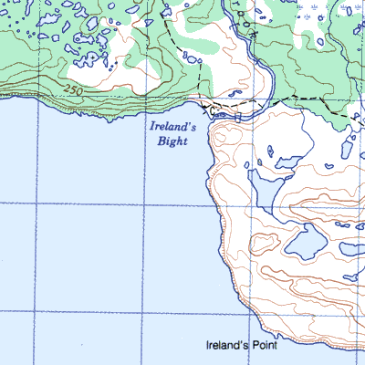
| Irelands Bight with Irelands Point | 2M/5 51° 21' 55° 46' |
1857/28 1874/50 1901/19 1911/44 1941/44 1961/28 |
fishing station from 1800 settled by 1857 abandoned after 1961 |
 | |
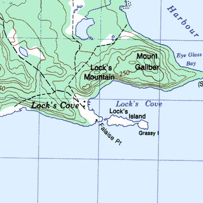
| Locks Cove | 2M/5 51° 20' 55° 57' |
1874/33 1901/64 1921/12 1941/29 1966/82 |
French fishing station settled by 1874 abandoned after 1966 |
 | |
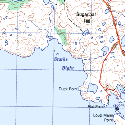
| Starks Bight (Birch Cove) | 2M/5 51° 19' 55° 40' |
1874/111 1891/18 |
settled 1870 abandoned after 1900 |
 | |
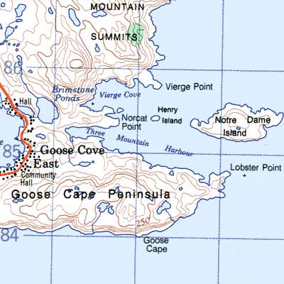
| Three Mountain Harbour | 2M/5 51° 18' 55° 37' |
1857/5 1935/20 |
settled by 1857 abandoned by 1955 |
 | |
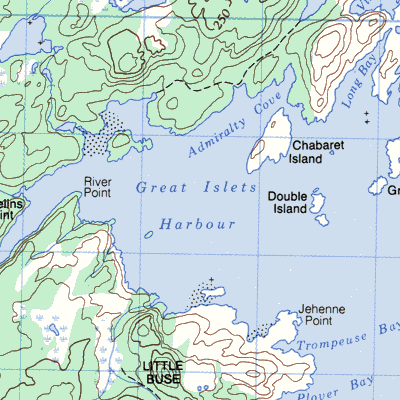
| Zealot (Great Islets Harbour) | 2M/4 51° 09' 55° 45' |
1874/19 1891/11 1911/4 |
French station until 1870 settled by 1874 abandoned after 1911 |
 |