| Place | Map Lat. N Lon. W |
Population Year/People |
History | Topo Map | |
| Crouse (Northeast ~) | 2L/13 50° 54' 55° 53' |
1874/28 1911/5 1935/28 1941/28 1945/39 1971/43 1976/22 |
French station to 1904 settled by 1874 abandoned by 1980 |
 | |
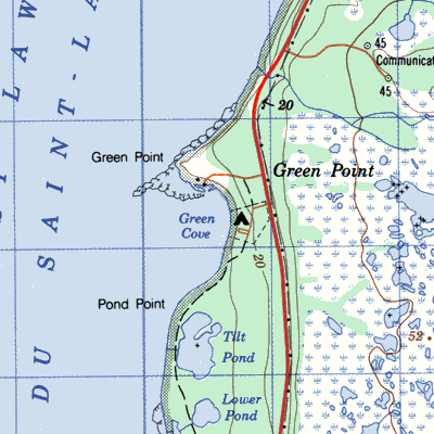
| Green Point (~ Cove) | / | 1869/21 1874/10 1911/7 1935/12 1956/42 1961/60 1966/82 1971/75 1976/58 |
French station from 1800 settled about 1860 abandoned 1980 |
 | |
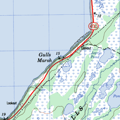
| Gulls Marsh | 12H/13 49° 47' 57° 53' |
1891/9 1901/22 1921/16 |
settled by 1890 abandoned after 1921 |
 | |
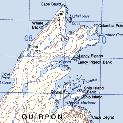
| L'anse Au Pigeon (Pigeon Cove), Quirpon Island | 2M/11 | 1935/37 1941/27 |
settled by 1935 abandoned after 1941 |
 | |
| Little Brehat | 2M/5 51° 27' 55° 29' |
1941/88 | / | 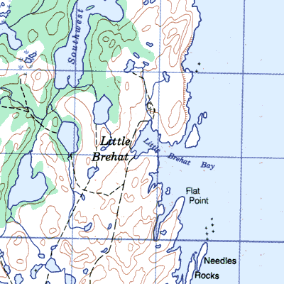 | |
| Martins Point | / | 1901/9 1935/10 1966/8 |
settled by 1870 abandoned by 1966 |
||
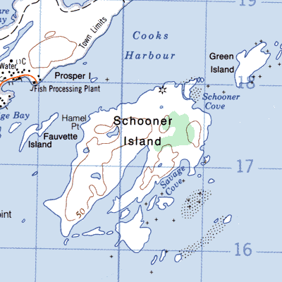
| Schooner Island, Pistolet Bay | 2M/12 51° 36' 55° 50' |
1873/16 1874/22 1884/9 |
settled about 1870 abandoned by 1900 |
 | |
| Seal Island, St. Barbe | 12P/7 51° 17' 56° 46' |
1874/29 1921/19 1945/26 |
settled 1860's abandoned by 1960 |
||
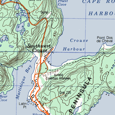
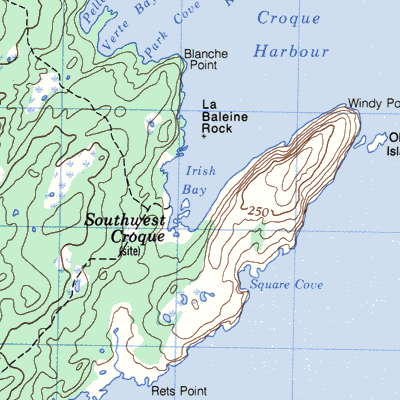
| Southwest Croque | 2M/4 51° 02' 55° 48' |
1921/8 1945/22 1956/39 |
French station until 1870 settled 1850's abandoned 1960's |
 | |
| St. Genevieve Bay, (Pond Cove) | 12P/2 51° 08' 56° 52' |
1874/45 1884/24 1935/9 1966/19 |
settled by 1850 abandoned by 1966 |
 | |
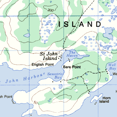
| St. John Island, St. John Bay | 12I/14 50° 49' 57° 14' |
1838/38 1869/23 1874/38 1901/12 1935/25 |
French station until 1904 settled by 1850 abandoned by 1945 |
 |