| Place | Map Lat. N Lon. W |
Population Year/People |
History | Topo Map |
| Bay de l'Eau Island | 1M/12 47° 31' 55° 39' |
1836/25 1867/73 1874/50 1941/45 1945/42 |
used before 1800 settled by 1835 abandoned by 1951 |
 |
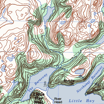
| Little Bay (~ ~ West) |
1M/5 47° 30' 55° 42' |
1836/47 1869/85 1921/145 1951/117 1966/84 |
settled late 1700's abandoned 1970 |
 |
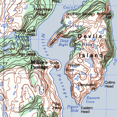
| Millers Passage |
1M/12 47° 31' 55° 39' |
1869/89 1935/142 1966/108 |
settled 1815 abandoned 1968 |
|
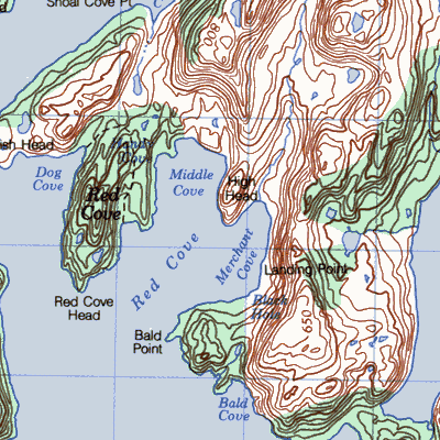
| Red Cove |
1M/12 47° 32' 55° 37' |
1836/11 1874/30 18912/50 1921/82 1941/98 1945/117 |
settled 1820's abandoned 1963 |
 |